California Wildfire Predictor Website Launch
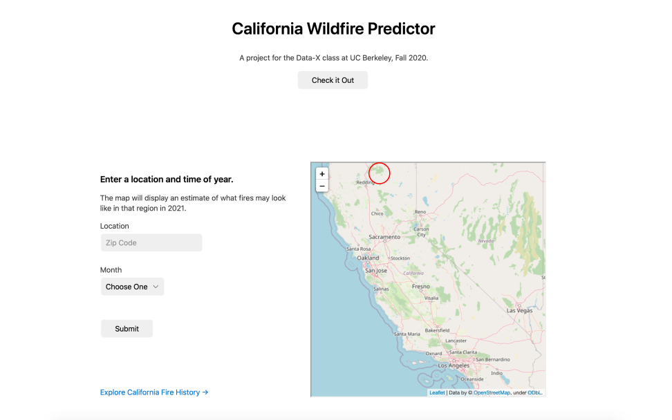
Since 1895, nearly 36 million acres of Califonia have caught on fire – that is roughly 34% of California’s total acreage. In the last few years, California is burning four times as fast as in the past. The California Wildfire Predictor team created a predictive model that is aimed at serving firefighters, insurance companies, and residents living in fire-prone neighborhoods. A user can navigate to the model on our live website linked below. The team’s SVR model takes in two inputs: month and zipcode. The model then takes the inputs and then predicts the number of acres that will burn if a fire started in that county in the specified month. The number of acres output is accompanied by a helpful interactive visualization that shows a scaled red circle detailing how large the fire will be and the county in which it occurs.
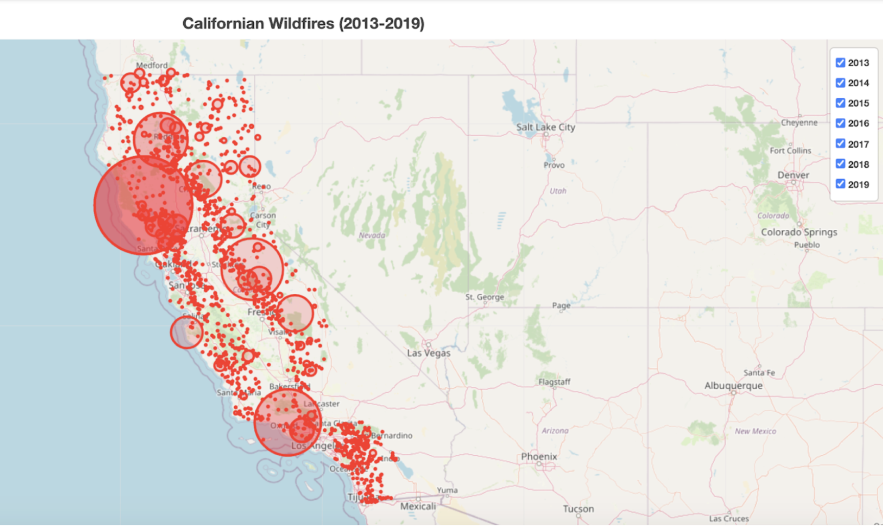
The website also has an explore page in which users can interact with previous historical fire data. Below is a visualization that is featured on this page. Users can see all of the fire data from 2013-2019. They can also select specific fire data to see which years had particularly severe fires.
By Christine Chow, Deevy Bhimani , Michael Damsky, William Pu, IEOR 135 | November 20, 2020
Code Here: https://github.com/mdamsky/california_wildfires